 If you have never played with google earth then you still have a good bit to learn about wasting time.
Having said that, if you are lucky enough to live in a place where the satellites take a close look it is possible to get some good aerial photos of home (or just about anywhere else).
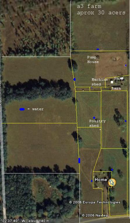
I pulled this photo of our farm and did an edit of it. Cool, huh?
I added indications of where the rotational grazing paddocks are, where water is available, and where the various buildings are.
The upper and lower left is adjoining land that we don’t use. The center left is land that belongs to my neighbor that we graze. It is subdivided into two paddocks at the moment. The large rectangle at the right is our land.
No comments:
Post a Comment